Wilderness Hiking
Menu
  • About
  • Quebec
    • Capitale nationale
    • Eastern Townships
    • Lanaudière
    • Laurentides
    • Montérégie
    • Montreal
  • Adirondacks (NY)
    • List of High Peaks
    • High Peaks (Blog)
    • List of Fire Towers
    • Fire Tower (Blog)
    • Lean-to
    • Rules and Guidelines
  • White Mountains (NH)
    • Presidential Range
  • Tips & How To

Mont Ouareau


By Richelle | June 7, 2016 | Category Lanaudière

Region : Lanaudière (Qc)
Start : Parking lot
Distance from start : 5 km roud trip (+links to Sentier National)
Parking : Yes
Fee : Free
Trail Markings : Color markings
Difficulty : Intermediate
Washroom: The woods
Map :
Annexe :
Website : No official website for this hike.
Other reference: Parc Régionaux de la MRC Matawinie
Location : Sentier du Mont Ouareau
Weather : Weather Conditions
Date of hike : 2016-06-07 (Richelle, Ben R., André B.)
This is a small mountain that you can climb in 3 hours, if you take your time to look for mushrooms like we did. The ascent is constant yet easy.

The start

The parking lot leads directly to the trail. There are no washrooms as this is a free trail. If you need facilities, you can go to the Reception of the Ouareau Forest Regional Park, which is just 10 minutes away.

The trail.

Even though this trail is free, it is very well maintained.

Once you get to 3/4 of the ascent, you will come to an intersection where you can either go right on the blue trail or continue on the left with the red trail you were following from the start.

I suggest taking the blue trail on the way up as you will see a beautiful viewpoint (.1km detour) on Lake Ouareau before heading to the top for the final 0.6km.

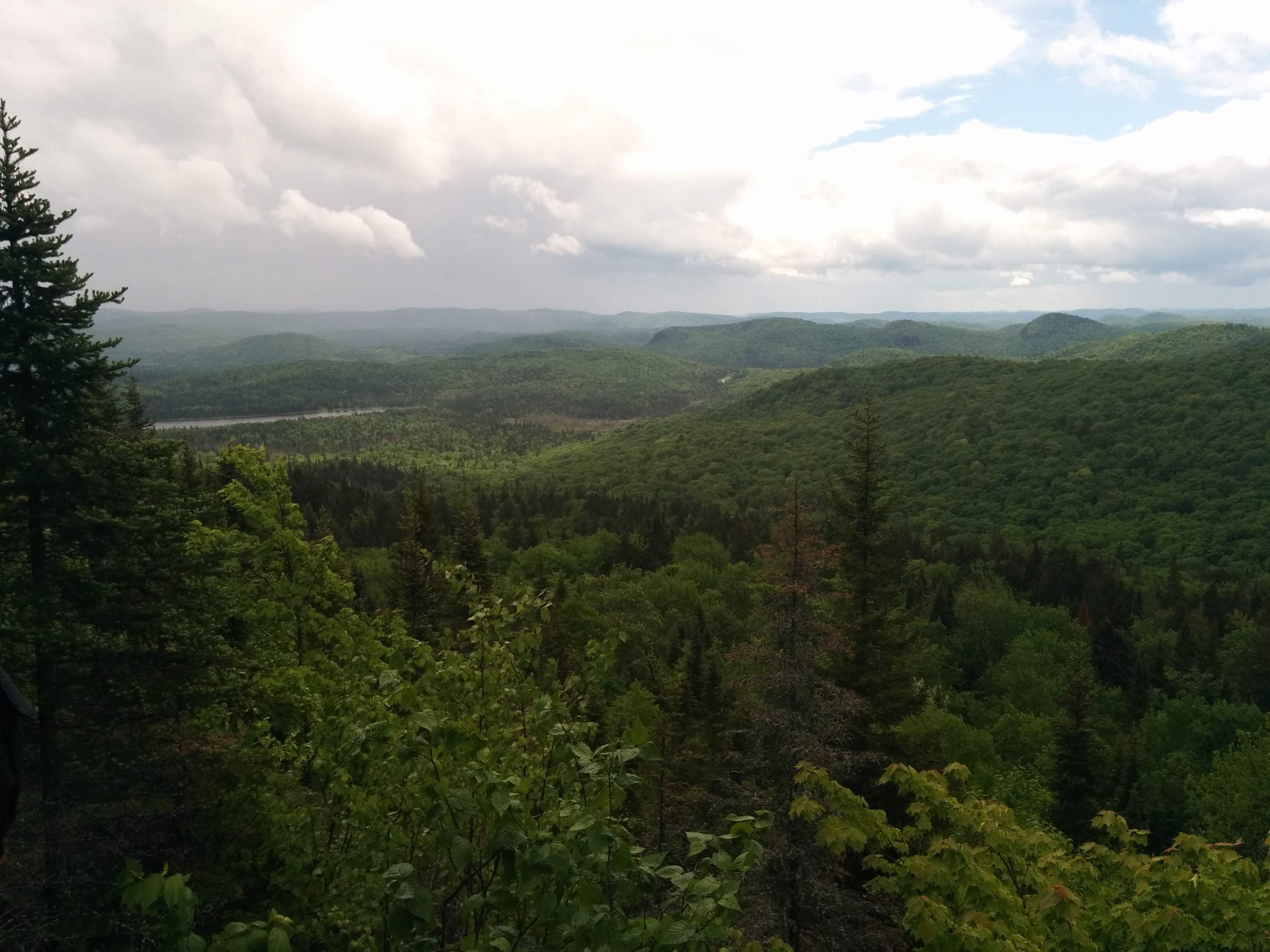
At the top, there is also a beautiful viewpoint on the infinite forest. As usual, we went on a tuesday, meaning that the trails were empty and quiet.

Lake Ouareau view from Mont Ouareau - 1st viewpoint

Lake Ouareau view from Mont Ouareau – 1st viewpoint

A beautiful view from the Summit. You can see the rain clouds gathering

A beautiful view from the Summit. You can see the rain clouds gathering

Alternate paths

once you reach the top, you can either

  • Go back to the parking lot
  • Continue on the Lac Lemieux trail, which will lead you to a refuge (+6km), which you can reserve in advance for a nights stay.
  • Continue past Lac Lemieux (+3.7km) up to the second parking lot where you would have parked a second car to get you home (don’t forget to go back and get your 1st car)
  • Continue pas Lac Lemieux to the south on the Sentier National to reach Mount Kaaikop (10$ fee may apply)

In our case, we just headed back home because it was raining cats and dogs and our friend, conveniently, had plans for the evening.

I look forward to coming back and taking the alternate paths.

Happy Hiking.


Tags: dogs allowed, free, hike, lake, lanaudière, refuge

Leave a Reply Cancel reply

Your email address will not be published. Required fields are marked *

Recent Posts


  • Sept Chutes Regional Park
  • Cap-Saint-Jacques Park
  • Morgan Arboretum
  • Poke-O-Moonshine
  • Saint Adolphe D’Howard Trails
  • Mont Rougemont
  • Mont Durocher – Sainte Adèle
  • Les Sentiers Brandon
  • Mont Kaaikoop
  • Hautes-Gorges-de-la-Rivière-Malbaie National Park

Pages


  • About
  • Adirondacks
  • Fire Tower

Tag Cloud


adirondacks Agriculture app beach bike camping capitale-nationale dogs allowed eastern townships fire tower fishing free high peaks hike hiking tips lake lanaudière laurentides lean-to legend Montreal montérégie park path explorer ravine refuge river rules & guidelines stream summit swamp SÉPAQ waterfall white mountains winter hiking

Categories


  • Adirondacks (NY)
    • Fire Tower
    • High Peaks
    • Lean-to
    • Rules and Guidelines
  • News
    • Potential Trails
  • Quebec
    • Capitale nationale
    • Eastern Townships
    • Lanaudière
    • Laurentides
    • Montérégie
    • Montreal
  • Tips & How To
  • White Mountains (NH)
    • Presidential Range

Recent Posts

  • Sept Chutes Regional Park
  • Cap-Saint-Jacques Park
  • Morgan Arboretum
  • Poke-O-Moonshine
  • Saint Adolphe D’Howard Trails
  • Mont Rougemont
  • Mont Durocher – Sainte Adèle
  • Les Sentiers Brandon
  • Mont Kaaikoop
  • Hautes-Gorges-de-la-Rivière-Malbaie National Park

Tag Cloud

adirondacks Agriculture app beach bike camping capitale-nationale dogs allowed eastern townships fire tower fishing free high peaks hike hiking tips lake lanaudière laurentides lean-to legend Montreal montérégie park path explorer ravine refuge river rules & guidelines stream summit swamp SÉPAQ waterfall white mountains winter hiking

Pages

  • About
  • Adirondacks
  • Fire Tower

Categories

  • Adirondacks (NY)
    • Fire Tower
    • High Peaks
    • Lean-to
    • Rules and Guidelines
  • News
    • Potential Trails
  • Quebec
    • Capitale nationale
    • Eastern Townships
    • Lanaudière
    • Laurentides
    • Montérégie
    • Montreal
  • Tips & How To
  • White Mountains (NH)
    • Presidential Range

Copyright © 2015 Wilderness Hiking

Theme created by PWT. Powered by WordPress.org