Nun-da-ga-o Ridge
Region : High Peaks / Eastern Section
Start Location : Crow Clearing
Distance from start : Full Ridge : 9.79km /Crow Clearing to Lost Pond : 3.38km (2.1mi)
Parking : Parking Lot
Trail Markings : DEC marker – Well marked
Fire pit : At the lean-tos
Toilet : At the lean-tos
Elevation: 970 m (3182 ft) At Weston Mountain
Weather Conditions : Keene (NY)
Winter : O’Tool Lane is not plowed all the way in the winter so you have to start the trail a little further away. To make it to the parking from the bottom of O’tool lane in the winter, the road can be very hard.
Dates :
- Summer 2012 (Big Crow / Little Crow : Richelle, Ben R. Caro L., André B.)
- August 19-20, 2013 (Ridge + Lean-to :Richelle, Ben R. Caro L., André B.)
- Summer 2014 (Lean-to :Richelle & Ben R.)
- June 14, 2016 (Ridge : Richelle, Ben R., André B, Gabrielle P.)
On our hike date in 2013, we started towards the lean-to and in 2016, we started the loop at Big Crow Mountain.
I highly suggest doing the later. You start off rough going up big crow mountain and end on the 2mi flat, easy hike from lost pond. Even though you will probably be tired, you can practically run it. That’s how flat it is! 🙂
The start
There are two starting points at Crow Clearing. The first one you will see when you arrive, which crosses a little bridge, leads you on the east to west trail, which starts at the lean to.
The second one is the west to east trail which starts on big crow.
Big Crow
About 50m after the start you will be met with an abrupt ascent up Big Crow Mountain. If you stick to the Nun-Da-Ga-O trail, you will not go to the summit. The detour is 1.1 mile.
Ironically (or is it), there was a big crow flying around and kaw-ing (is that a word?) on the mountain. Was it named after his ancestors?

Nun-da-ga-o/Big Crow intersection
The ridge
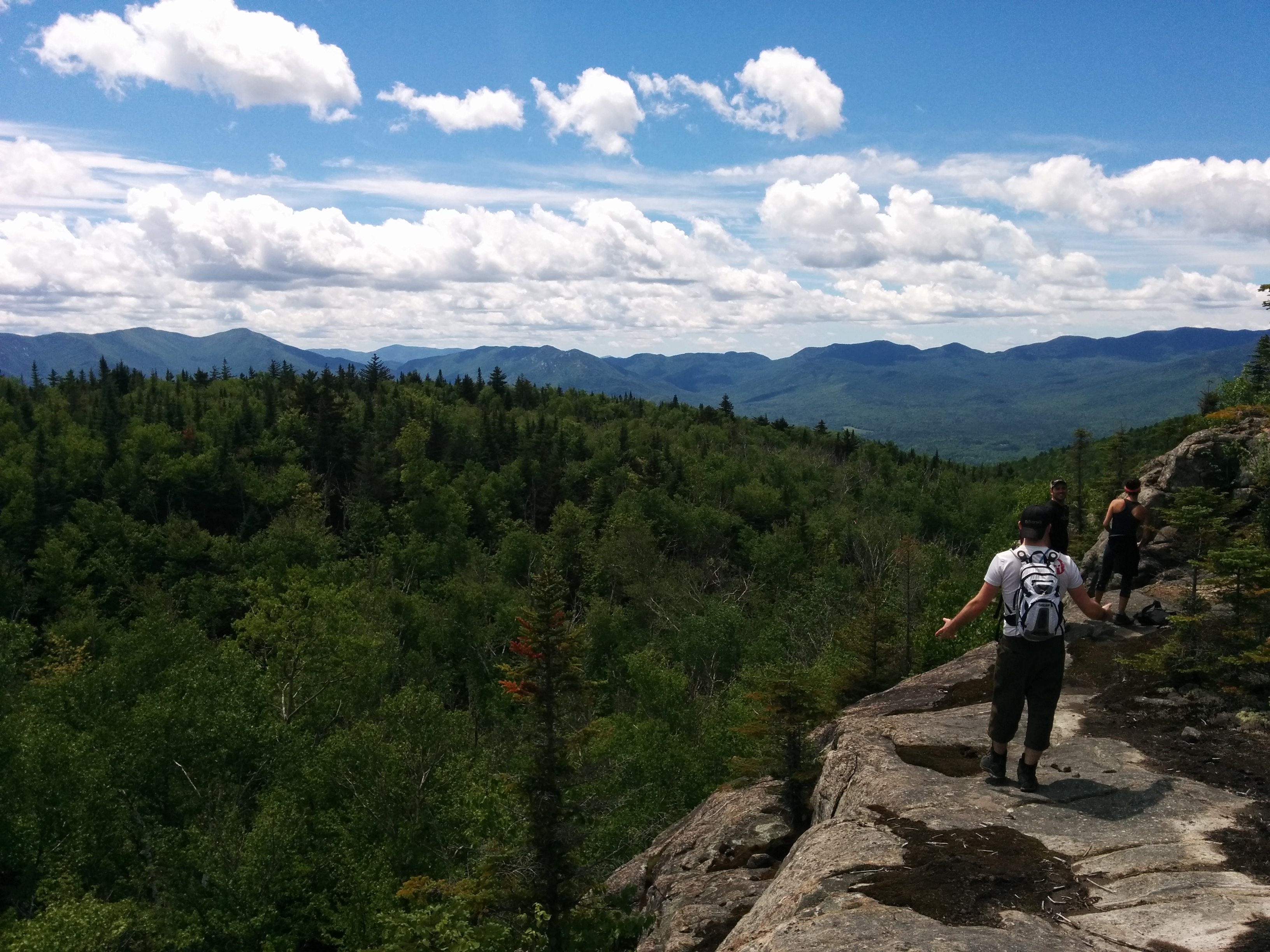
Once you’ve ascended the ridge, most of the hike is flat with sporadic ascents. A lot of the time on top, youwill be on the ridge with amazing views of Big Crow/Little Crow, Oak Red Ridge, Potash and Sentinel range in the back (from what I was able to gather with my map reading skills…which are pretty decent).
When you are not on the ridge, you will be in a beautiful, fresh smelling forest.
There are a couple of rocky cliffs that you have to climb which are very fun but be careful if you have kids (and good luck if you have a big bag…you’re gonna need it).

One of the many view points from Nun-da-ga-o ridge
Weston Mountain:
This is the last view point from the ridge. You’ll know you’re there because there is a decent ascent before the summit. This is one of the most rewarding views because you get to see the ridge and big crow mountains. We just would sit there in awe at what we accomplished.

The view of Big Crow/Little Crow and Nun-da-ga-o ridge
Once you got over it, head back into the woods for the easiest part : The descent + 2.1 mi of flat.
Lost Pond & Biesmeyer Memorial Lean-to :
The trail between lost pond and Crow Clearing is pretty easy going with no significant elevations.
The lean to is well kept. We slept there twice and were grateful that the previous hikers left us some chopped up wood. The only unfortunate part of this lean-to is that there is absolutely no view. The bushes around the pond are high so even if you want to go down there, if you’re short, there isn’t much to see.
There is a clearing on the other side of the pond, along the lost pond – crow clearing trail with a “beach” where you can take a break by the pond. There will be no easy access to the pond at the Lean-to so you have to enjoy it now.
You will finally follow the pond to the other end where the Lean-to is.

Lost Pond

Biesmeyer Lean-to
Gulf Brook Lean-to :
This lean-to is 1 mile up the road from Crow Crossing, past the intersection to Hurricane mountain. They moved it 100m-sh a couple of years back but didn’t move the toilet. If you are looking for it, it’s slightly elevated near the path to hurricane mountain.
The trail follows a little stream back to the parking lot.
As usual, we ended up buying a 12 pack of the Saranac local beer and our friend got some Blue Moon White beer, which we enjoyed on the hike. Even though hiking is rough, it’s always been important to me to take my time and relax. Don’t rush you hike, worst case scenario, you finish 1-2 hours later than expected but 10x more relaxed.
Happy Hiking