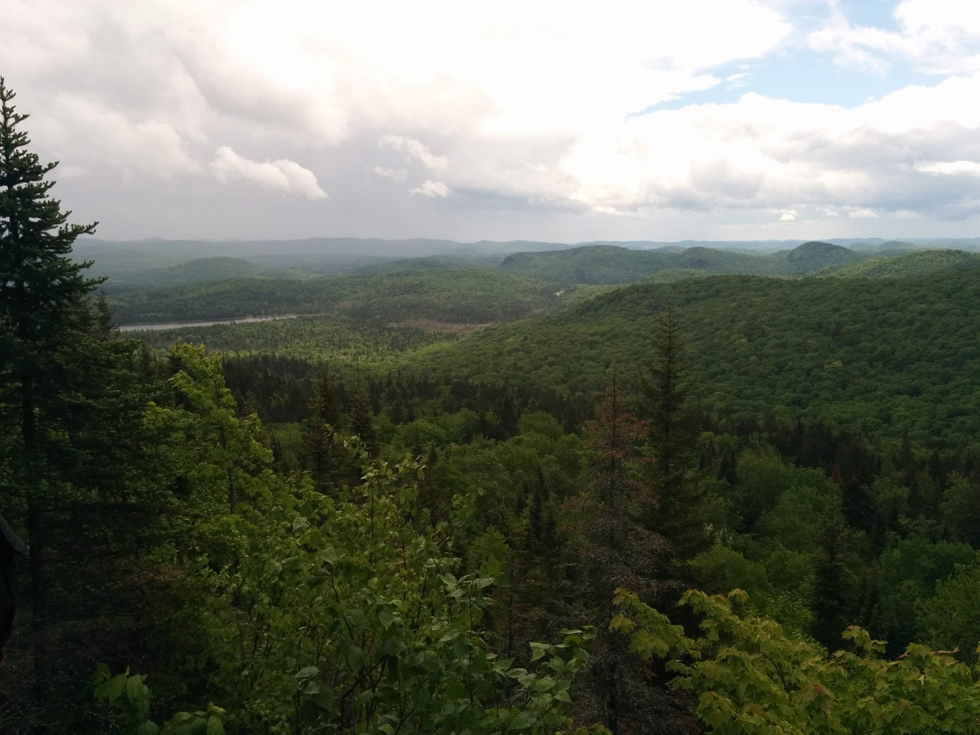
Wilderness Hiking
Menu
  • About
  • Quebec
    • Capitale nationale
    • Eastern Townships
    • Lanaudière
    • Laurentides
    • Montérégie
    • Montreal
  • Adirondacks (NY)
    • List of High Peaks
    • High Peaks (Blog)
    • List of Fire Towers
    • Fire Tower (Blog)
    • Lean-to
    • Rules and Guidelines
  • White Mountains (NH)
    • Presidential Range
  • Tips & How To

Tag Archives: lake


Sept Chutes Regional Park

By Richelle | October 24, 2017 | Category Lanaudière

23.2 km • Intermediate

Read More

Mont Kaaikoop

By Richelle | October 9, 2016 | Category Lanaudière

12.2km • Intermediate

Read More

Oka National Park

By Richelle | October 6, 2016 | Category Laurentides

7km • Easy

Read More

Nun-da-ga-o Ridge

By Richelle | June 15, 2016 | Category Adirondacks (NY), High Peaks, Lean-to

9.8km • Intermediate/Hard

Read More

Mont Ouareau

By Richelle | June 7, 2016 | Category Lanaudière

Region : Lanaudière (Qc) Start : Parking lot Distance from start : 5 km roud trip (+links to Sentier National) Parking : Yes Fee : Free Trail Markings : Color markings Difficulty : Intermediate Washroom: The woods Map : Annexe : Website : No official website for this hike. Other reference: Parc Régionaux de la […]

Read More

Sainte Adèle – Mont Loup Garoup

By Richelle | April 23, 2016 | Category Laurentides, Quebec

Region : Laurentides (Qc) Start : Chemin du paysan, Ste-Adèle Distance from start : 24km Parking : Designated parking area Fee : Free Trail Markings : Very well identified Difficulty : Easy – Intermediate Washroom: None Map : General map / Hiking map / Ski trail map Website : Plein air Sainte-Adele / Plein air […]

Read More

Réserve naturelle Alfred-Kelly – Parc des Falaises

By Richelle | April 20, 2016 | Category Laurentides, Quebec

Region : Laurentides (Qc) Start : Gare de Prévost Distance from start : 15km Parking : At the Gare – Big parking lot Fee : Free Trail Markings : Blue markers/Arrows Difficulty : Medium Washroom:  At the Gare (Closes around 4pm – Restaurants available around) Map : Click here Date of hike : April 19, […]

Read More

Mont Sutton

By Richelle | September 7, 2015 | Category Eastern Townships, Quebec

Region : Estrie (Qc) Start : Reception Shack Distance from start : Over 50km Parking : At the reception desk Fee : 6$/adult Trail Markings : Well identified on main trails Difficulty : Intermediate/Hard Washroom: At the reception Desk (Chemin Réal) Map : Park map (You can buy a copy at the reception – Plastic […]

Read More

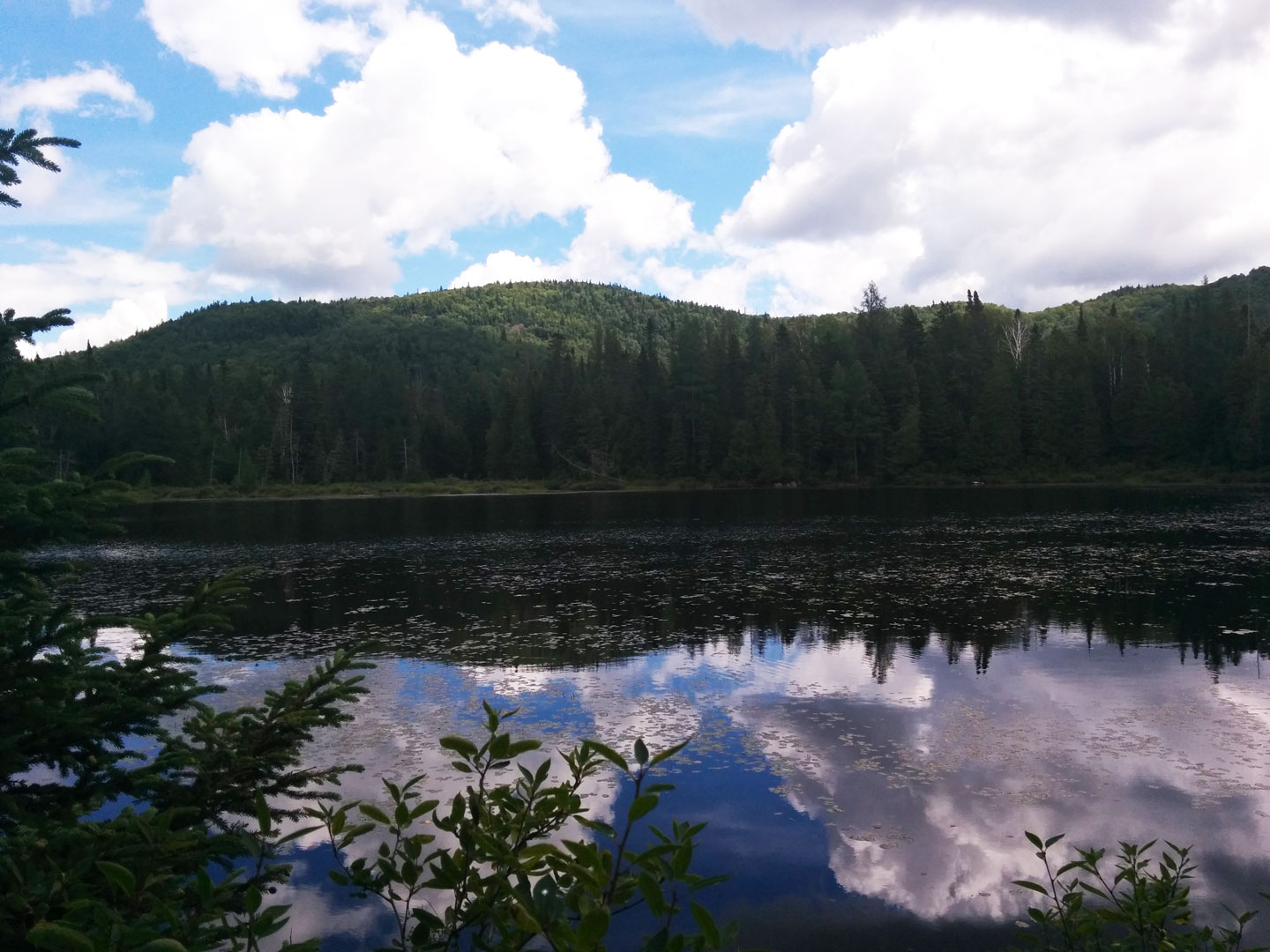
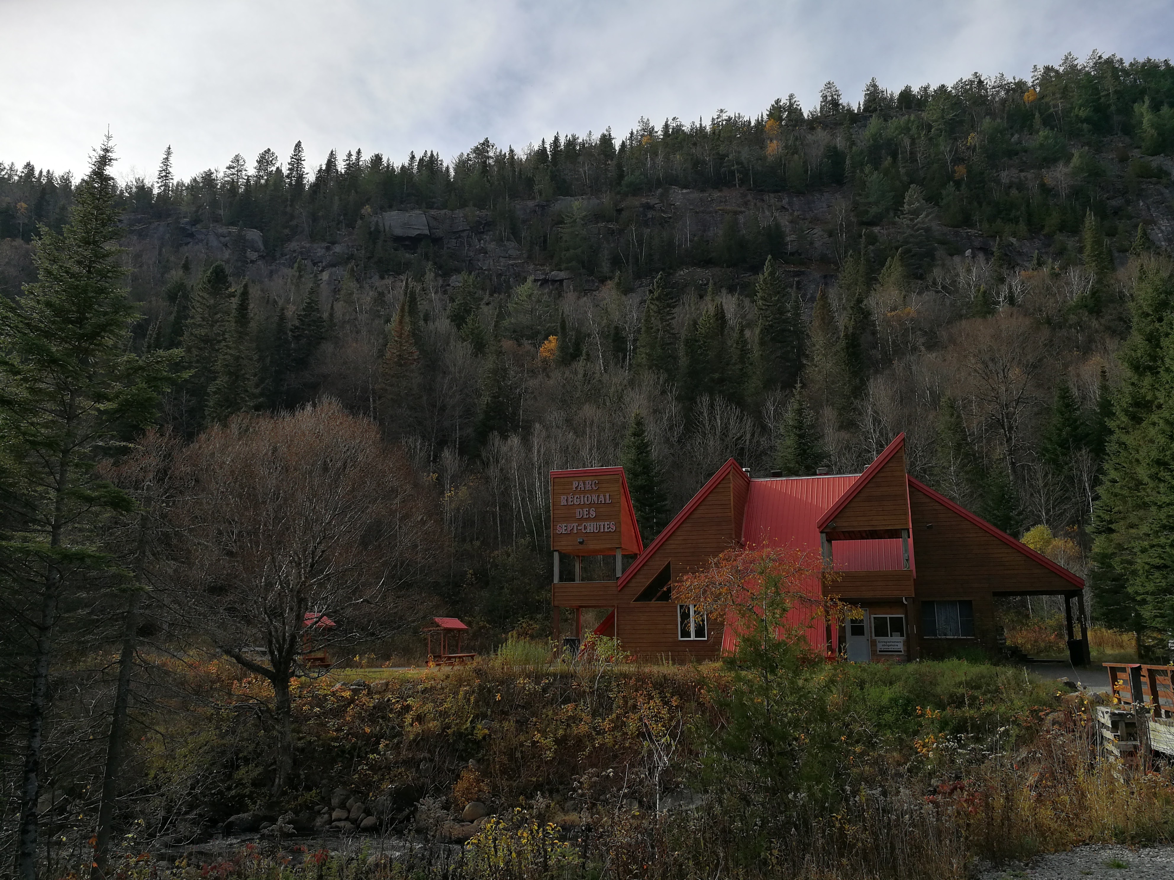
Forêt Ouareau Regional Park

By Richelle | August 1, 2015 | Category Lanaudière, Quebec

Region : Lanaudière (Qc) Start : Parking lot Distance from start : Up to 120km (+links to Sentier National) Parking : Yes Fee : 6$ Trail Markings : Color billboards Difficulty : Intermediate to Hard Washroom: At the Refuge & Reception Map : • Map : Massif Sector • Map : Grande Vallée Sector • Map : […]

Read More

Mont Saint-Bruno National Park

By Richelle | May 9, 2015 | Category Montérégie, Quebec

Region : Montérégie (Qc) Start : Discovery Center Distance from start : About 9km (Depends on Trail) Parking : Discovery Center Fee : Trail Markings : Difficulty : Easy Washroom: Map : Website : http://www.sepaq.com/pq/msb/index.dot Note: Bike Path Date of hike : November 18, 2014

Read More

Previous Posts

Recent Posts


  • Sept Chutes Regional Park
  • Cap-Saint-Jacques Park
  • Morgan Arboretum
  • Poke-O-Moonshine
  • Saint Adolphe D’Howard Trails
  • Mont Rougemont
  • Mont Durocher – Sainte Adèle
  • Les Sentiers Brandon
  • Mont Kaaikoop
  • Hautes-Gorges-de-la-Rivière-Malbaie National Park

Pages


  • About
  • Adirondacks
  • Fire Tower

Tag Cloud


adirondacks Agriculture app beach bike camping capitale-nationale dogs allowed eastern townships fire tower fishing free high peaks hike hiking tips lake lanaudière laurentides lean-to legend Montreal montérégie park path explorer ravine refuge river rules & guidelines stream summit swamp SÉPAQ waterfall white mountains winter hiking

Categories


  • Adirondacks (NY)
    • Fire Tower
    • High Peaks
    • Lean-to
    • Rules and Guidelines
  • News
    • Potential Trails
  • Quebec
    • Capitale nationale
    • Eastern Townships
    • Lanaudière
    • Laurentides
    • Montérégie
    • Montreal
  • Tips & How To
  • White Mountains (NH)
    • Presidential Range

Recent Posts

  • Sept Chutes Regional Park
  • Cap-Saint-Jacques Park
  • Morgan Arboretum
  • Poke-O-Moonshine
  • Saint Adolphe D’Howard Trails
  • Mont Rougemont
  • Mont Durocher – Sainte Adèle
  • Les Sentiers Brandon
  • Mont Kaaikoop
  • Hautes-Gorges-de-la-Rivière-Malbaie National Park

Tag Cloud

adirondacks Agriculture app beach bike camping capitale-nationale dogs allowed eastern townships fire tower fishing free high peaks hike hiking tips lake lanaudière laurentides lean-to legend Montreal montérégie park path explorer ravine refuge river rules & guidelines stream summit swamp SÉPAQ waterfall white mountains winter hiking

Pages

  • About
  • Adirondacks
  • Fire Tower

Categories

  • Adirondacks (NY)
    • Fire Tower
    • High Peaks
    • Lean-to
    • Rules and Guidelines
  • News
    • Potential Trails
  • Quebec
    • Capitale nationale
    • Eastern Townships
    • Lanaudière
    • Laurentides
    • Montérégie
    • Montreal
  • Tips & How To
  • White Mountains (NH)
    • Presidential Range

Copyright © 2015 Wilderness Hiking

Theme created by PWT. Powered by WordPress.org